


THE ROUTE OF ICONS
Opis produktu
TYPE OF THE ROUTE: cycling
LENGTH OF THE ROUTE: approximately 90 km
THE ROUTE:
Nová Sedlica – Uličské Krivé – Ulič – Ruský Potok – Topoľa – VN Starina – Jalová – Stakčín – Kalná Roztoka – Ubľa – Dúbrava – Šmigovec – Hrabová Roztoka – Strihovce – Kolonickie Sedle Astronomic Observatory
THE HEIGHT PROFILE:
DESCRIPTION OF THE ROUTE:
Day 1
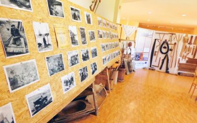
Nová Sedlica, the village that is farthest to the east of the whole Slovakia, from here you can also go along the red trail to the triangle of the borders of SK-PL-UA on Mount Krzemieniec (1221 m above sea level). In the cultural centre there is an exhibition hall with artefacts connected with the Wallachian culture. Going south, you will reach Ulickie Krivé, where you will find a wooden Greek-Catholic Orthodox church from 1778 with a beautiful iconostasis from the 18th century.
Another village is Ulič, where in the center of the miniature park of wooden Orthodox churches on a scale of 1:10 from the surrounding villages; you can plan what kind of Orthodox church you want to see in the original. In addition, over the village we have the educational path “Doors to Poloniny”, where, among other things, we can learn how to recognize animals by their footsteps. If you leave Ulič, on your right you will have a side road to the Ruský Potok village, where there is a wooden Orthodox church of St. Michael the Archangel from the second half of the 17th century.
Further on past Kolbasov we have another fork, which will lead us to Topoľa, there is the Greek-Catholic Orthodox Church of St. Michael the Archangel from 1700. The church is located on a hill to the right of the road, beautiful arcades around the building add charm to the church. There is also a statue of Alexander Duchnovych, who was born here and lived in the years from 1803 to 1865. He was a Greek Catholic priest and a national Ruthenian activist, the initiator of the Ruthenians’ aspirations to create an autonomous state and the creator of the first Ruthenian reading primer.
We return to the crossroads and now we have to climb the Karcába Pass (500 m above sea level), go through Príslop, where there is a military cemetery from the World War I; after reaching the pass, we descend towards Starina reservoir, passing by the beautiful Carpathian flysch exposure. Starina Lagoon was established in 1987 and it is the largest drinking water reservoir in Slovakia and Central Europe, supplying water to many cities in eastern Slovakia, such as Prešov and Košice. The zone around the reservoir is protected and it is not allowed to camp and do water sports, near the dam above the road there is a beauty spot for tourists. The dam itself, located on the Cirocha River, is of the natural type (loose), 50 m high and 345 m long. Behind the dam there is a side road to the village of Jalova, where there is also a wooden St. George’s Orthodox Church built in 1792. This Orthodox church was demolished in 2001 and reconstructed because it was in a very bad condition. On the way back, from the main road you will reach Stakčín.
Day 2
We head for Kalná Roztoka; from Stakčín, we go towards Ubľa and then turn left on the local road to Klenova. There is a wooden Greek-Catholic Orthodox church of St. John the Baptist from the eighteenth century situated on the hill. It is worth noticing the icon of the Last Supper in the iconostasis: on the table at which Christ sits with the apostles, there are only spoons.
Going further through Klenová, we get to the main road to Ubľa, in this village we turn right on Sobranka. Another side road is located in Dubrava, where we turn right to get to Šmigovec after 4 km. There is a newly renovated wooden Greek-Catholic Orthodox Church of the Feast of Ascension from 1894. At present, there is a gallery of Orthodox art inside the church and there are also paintings on the boards of the old church. Two kilometres away from Hrabová Roztoka we also have a wooden church of St. Basil the Great, built in the 18th century. Just like in Šmigovets, the church was converted into an Orthodox church in the 1950s, only after political changes it returned to Greek-Catholics. At present, the building is not in use due to the lack of believers.
Returning to Šmigovec, we turn left and go uphill on the slopes of the Wyhorlat mountain range. After passing Strihovce, we enter the dirt road behind the yellow hiking trail, after a while we reach the crossroads, we turn right and go around the main range of Wyhorlat. We drive along dirt road, which used to be the embankment of the narrow-gauge forest railway built in Austro-Hungarian times. We get to the crossroads, where the asphalt road goes down on the right, we turn and after about 1,5 km we get to the Astronomical Observatory and Planetary on Kolonica Saddle, which is open for everyone and have telescope observations on the Poloniny Dark Sky Night Park.
Dodatkowe informacje